Togo, Cropped Area
Satellite Data Informs Innovative Agricultural Loan Program in Togo
The effects of COVID-19 shutdowns in Togo, including many months of curfews, severely limited the ability of hundreds of thousands of the country’s small farmers to produce an adequate food supply, as well as to cultivate formerly robust crops, such as soy and cotton. To help its farmers, the Togolese government utilized a cropland data map developed by NASA’s Food Security and Agriculture Program, known as NASA Harvest, to develop a loan program that would help fund the cost of farming essentials.
In the past, farmers eligible for such loans would have been identified using Togo’s census data. However, the existing census only accounts for growers who list their primary occupation as farming. This vastly underestimates the number of informal smallholder growers impacted by the pandemic, who rely on subsistence farming to live, which is where satellite data can help fill in the gaps. When rapid action was needed and mobility across the country was limited due to the COVID-19 outbreak, satellite data offered an effective and rapid way to map the country’s distribution of croplands and characterize the nature of agricultural fields during the pandemic.
NASA Harvest developed a national level satellite-derived cropland map for Togo at 10-meter resolution within a 10-day timeframe using data from the European Space Agency’s Copernicus Sentinel 2, from commercial partner Planet Inc and from NASA-USGS Landsat satellites. These data, alongside poverty and census information, rapidly and effectively identified priority areas for the loan program. With the cropland maps, Togolese government officials had trustworthy information on the physical size and geographic location of agricultural lands that census data might have missed.
The NASA Harvest cropland map, in combination with poverty and census data, helps governments quickly and effectively target aid, such as small loans, to agrarian communities.
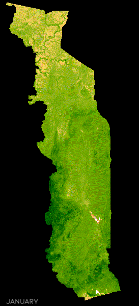
MODIS satellite imagery of Togo showing monthly average NDVI.
“[These maps] provide unmatched clarity into the nature and distribution of agricultural land nationwide,” said Cina Lawson, Minister of Posts, Digital Economy, and Technological Innovation in Togo. “On top of this map, we are overlaying data from poverty maps that we have developed in collaboration with UC Berkeley and Innovations for Poverty Action [IPA]. Together, they provide decisive knowledge being used to design social protection policies aimed at improving the livelihoods of agrarian rural communities.”
SkySat basemap 0.75cm resolution, of croplands surrounding Tchamba, Togo [image c/o Planet, Inc.]